Metadata Record -- Extent Section
Geographic Features Edit Window
The Features Edit Window allows geographic features for the Geographic Extent to be added and edited. Features may be added manually or imported if the features have been saved in one of the graphic standards supported by mdEditor.
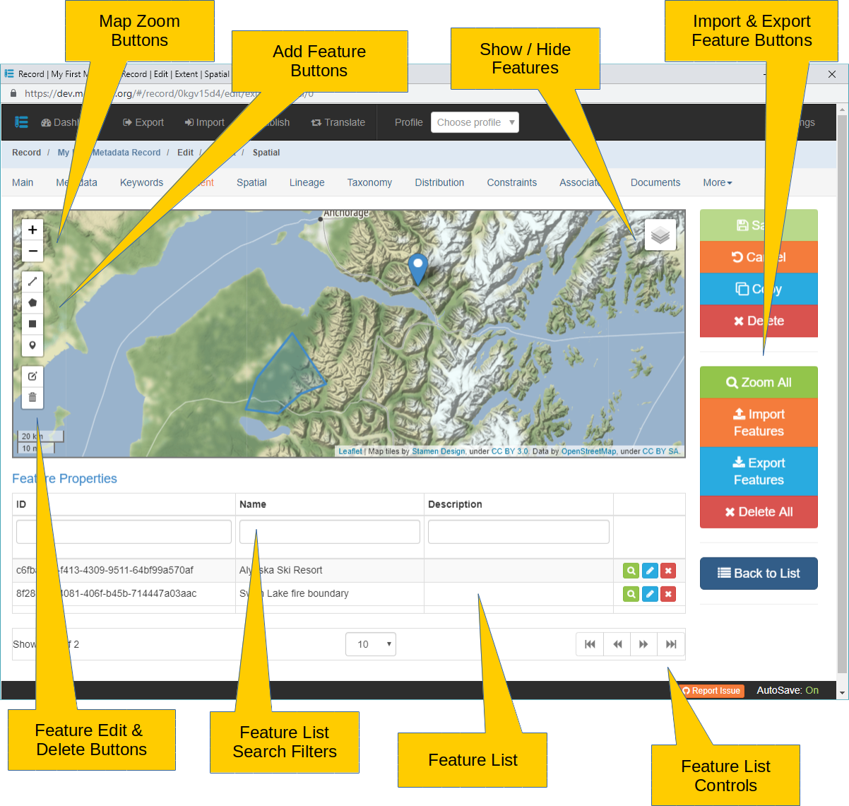
The map at the top of the page displays the Features that have been added to the Geographic Extent. On the left side of the map are button groups for modifying the map's display and adding and editing features. Mouse controls are also active over the map.
Map
Click to zoom map in to see more detail (smaller map scale).
Click to zoom map out to see greater area (larger map scale).
Map scale may also be zoomed in and out using the mouse scroll wheel while the cursor is hovering over the map.
The map may be panned by holding either the left or right mouse button down while moving the mouse over the map.
Zoom All Click to zoom the map scale in or out to display all Features in the Geographic Extent.
If the map tiles turn gray try zooming in and out to refresh. Also, the map will not display tiles at a resolution of less than 500 meters.
 Click to Show/Hide the Features layer over the map. Clicking the button will display a short menu with a "Extents" checkbox. If checked, features will be displayed. If unchecked, features will be hidden.