Metadata Record -- Extent Section
Geographic Extent Edit Window
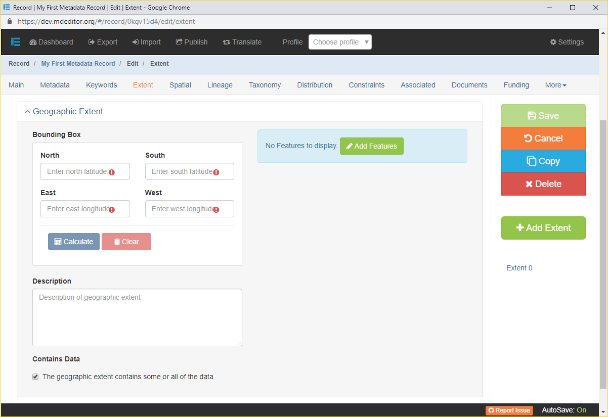
Bounding Box {type: collection}
Usage: The general geographic position of the resource defined by bounding latitudes and longitudes.North {type: real; min: -90.0; max +90.0; default: empty}
Usage: Northern-most coordinate of the limit of the dataset extent or area of interest expressed in latitude, in decimal degrees.South {type: real; min: -90.0; max +90.0; default: empty}
Usage: Southern-most coordinate of the limit of the dataset extent or area of interest expressed in latitude, in decimal degrees.East {type: real; min: -180.0; max +180.0; default: empty}
Usage: Eastern-most coordinate of the limit of the dataset extent or area of interest expressed in longitude, in decimal degrees.West {type: real; min: -180.0; max +180.0; default: empty}
Usage: Western-most coordinate of the limit of the dataset extent or area of interest expressed in longitude, in decimal degrees.Calculate If Features have been added to the Geographic Extent the button may be clicked to compute Bounding Box values for the collection of Features.
Bounding box coordinates are not automatically recalculated when Features are added, edited, or deleted. Click the Calculate button again after making changes to the Feature collection.
Clear Clear all Bounding Box elements.
Description {type: string; max length: none; default: empty}
Usage: A short description of the geographic areal domain of the data set. Examples include, "Manistee River watershed", "extent of 7½ minute quads containing any property belonging to Yellowstone National Park", or "ponds and reservoirs larger than 2 acres in Jefferson County, Colorado".Contains Data {type: Boolean; default: TRUE}
Usage: Indicates the Geographic Extent encompasses some or all the data for this Extent.Features {type: array (obj: Feature)}
Usage: An array of objects each describing a geographic boundary or location comprising all or a portion of the resource.When no Features have been defined for the Geographic Extent a large blue bar is displayed on the page declaring "No Features to display." Click the Add Features button to transfer to the Feature Edit Window where you can import or manually add and editFeatures.
After one or more Features have been added to the Geographic Extent a map will be displayed showing the features. See the image below.
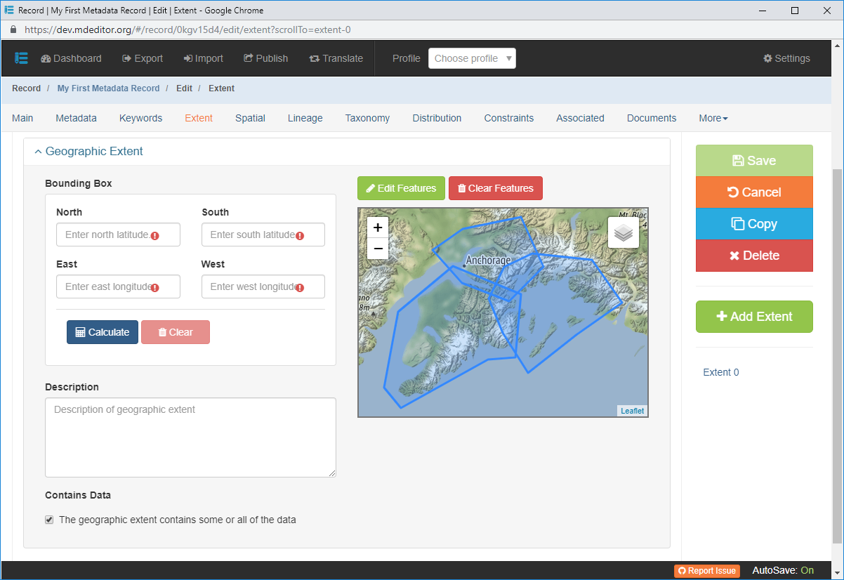
Image 2: Geographic Extent Edit Window with Features Edit Features Click to transfer to the Feature Edit Window where you can add new and edit existing Features.
Clear Features Remove all Features from the Geographic Extent.