Metadata Record -- Source
Spatial Resolution
Spatial Resolution {type: object ( Spatial Resolution); default empty}
Usage: The geographic scale of the main resource.
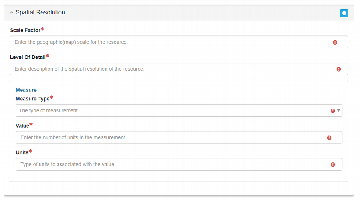
It is required to have at least one of the three Spatial Resolution elements, but multiple are permitted.
Scale Factor {type: integer; min: 0; max none; default: empty}
Usage: The geographic scale for the resource expressed as map scale (e.g. 1:24000) or fraction (1/24000); enter the denominator (e.g. 24000).Level of Detail {type: string; max length: none; default: empty}
Usage: A brief textual description of the spatial resolution of the resource.Measure {type: object (Measure); default empty}
Usage: Scale of the geographic extent expressed in distance, length, or angle parameters.
See object details
Measure Object
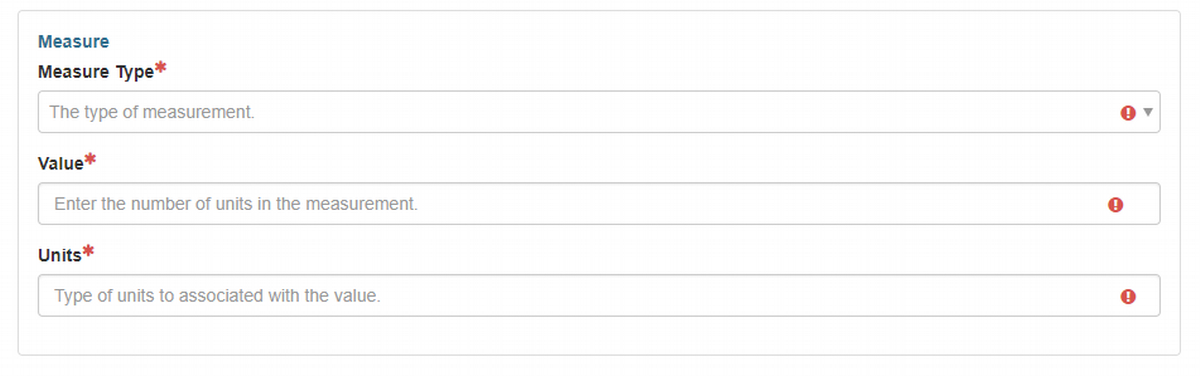
Measure Type {type: codelist (enumerated list); extensible: NO; multi-value: NO; default: empty}
Usage: An enumerated selection list: distance, length, angle, measure, scale.Value {type: real; min: 0; max none; default: empty}
Usage: The number of units in the measure.Units {type: string; max length: none; default: empty}
Usage: The name of the units associated with the Value.