Metadata Record -- Extent Section
Import Geographic Features
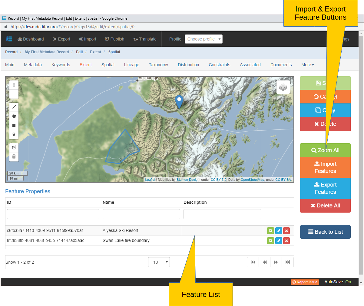
Some geographic features stored on your hard drive may be imported directly into mdEditor and saved as a geographic Feature. To be eligible for import the file must be saved in one of the supported formats listed below.
Import Features Click to import a feature file from your hard drive. Your operating system's file explorer will open to a default file location (such as the 'Downloads' folder). Select the file to import or navigate to the desired folder. Select the file to import and click "Open".
-or-
Drag & Drop The map supports dragging a file from your file explorer and dropping the feature file on the map. mdEditor will open the file and incorporate the feature(s).
CSV (Comma or Tab delimited) text file
The import process searches column heading names for clues to locating geographic and other information.
- A column name of "lat", "latitude", or "lat" + any other characters is assumed to contain the geographic latitude in decimal degrees.
- A column name of "lon", "longitude", or "lon" + any other characters is assumed to contain the geographic longitude in decimal degrees.
- A column name of "id" is assumed to contain the ID of the point and is saved in a editable field.
- A column name of "name" is assumed to contain the name of the point and is saved in a editable field.
- A column name of "description" is assumed to contain a description of the point and is saved in an editable field.
- All other column values are saved in read-only fields.
The CSV file can only import points.
KLM (Keyhole Markup Language) - used by Google Earth and others applications.
- A column name of "name" is assumed to contain the name of the feature and is saved in a editable field.
- A column name of "description" is assumed to contain a description of the feature and is saved in an editable field.
- All other column values are saved in read-only fields.
Shapefile (ESRI ArcGIS format) - A non-topological file format for storing the geometric location and attribute information of geographic features in XML structure.
- Vector shapefiles are not supported.
- Vector shapefiles are not supported.
GeoJSON (RFC 7946) - a geospatial data interchange format based in JavaScript Object Notation, JSON.
- A column name of "id" is assumed to contain the ID of the feature and is saved in a editable field.
- A column name of "name" is assumed to contain the name of the feature and is saved in a editable field.
- A column name of "description" is assumed to contain a description of the feature and is saved in an editable field.
- All other column values are saved in read-only fields.
GPX (the GPS eXchange Format) - a data format for exchanging GPS data between programs and users.